Fly Responsibly.
Explore Airspace with
Confidence.
safeFLY is the essential iOS map companion for drone pilots in Germany — now with added coverage for six neighbouring countries. Real-time control zones, nature reserves, multi-altitude wind profiles, and instant flight checks.
Requires iOS 18.0 or later.
Designed for Precision Flying
Check airspaces, plan pathways, and check hourly forecasts tailored directly for multicopters.
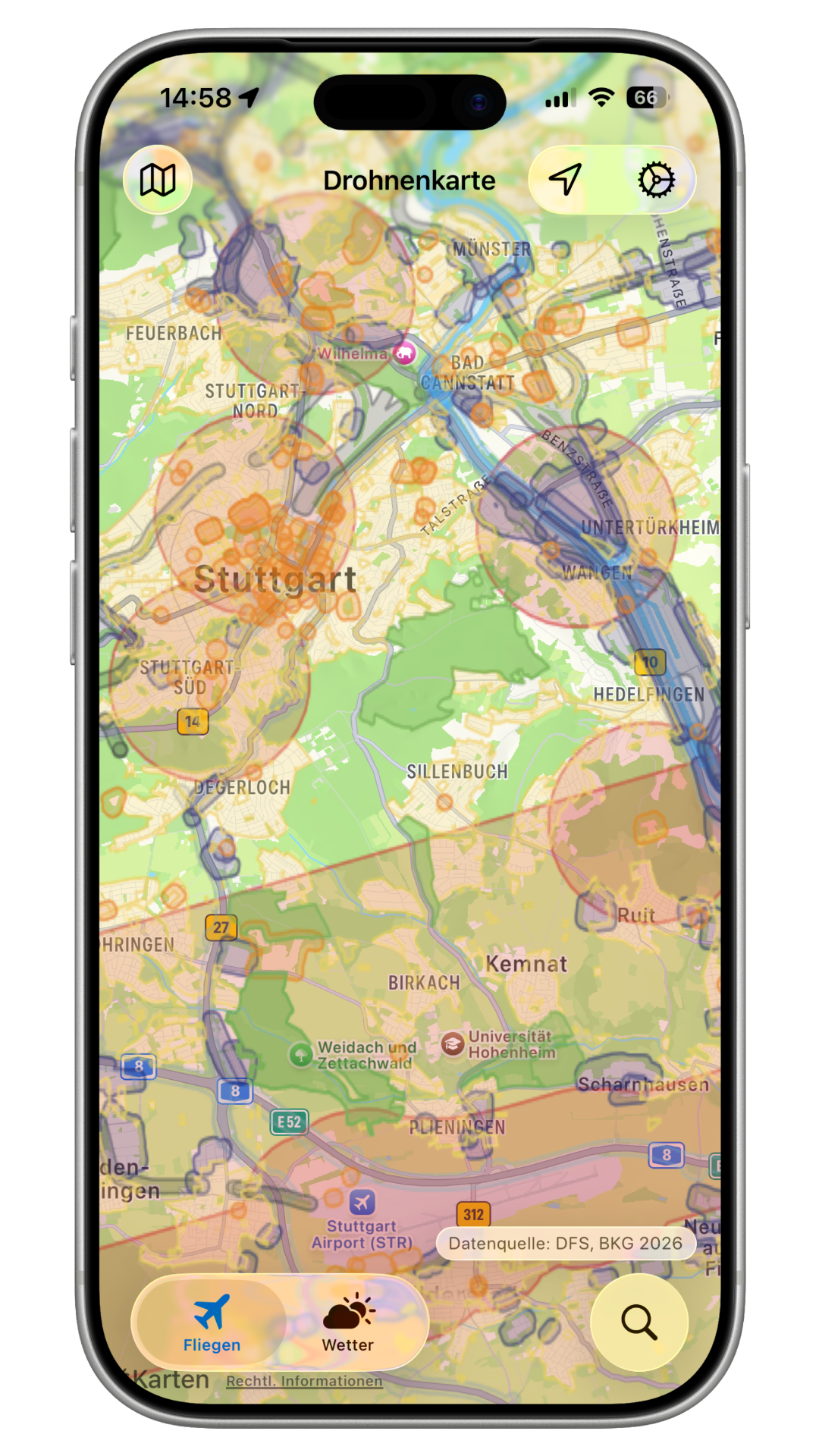
Official Geodata
Live airspace zones straight from Germany's official DFS (Air Traffic Control) and DIPUL portals — plus optional data from six neighbouring countries' own aviation authorities.
Overlapping Zones Info
Check rules for airports, railways, nature reserves, and constitutional bodies instantly. Detailed breakdown of coordinates and drone flight classifications.
Multilevel Wind Profile
Access wind speed profile at multiple altitudes (10m, 50m, 100m AGL) combined with maximum gust estimates to prevent low-altitude signal drift.
100% Open Source
safeFLY is open source and community-driven. View the source code, suggest features, or contribute directly to the project on GitHub.
Built for Germany. Extended across the region.
safeFLY's home is Germany, powered by official DFS and DIPUL data. On top of that, you can switch on drone-zone data for six neighbouring countries in Settings — each sourced directly from that country's own aviation authority.
See your coverage at a glance
The map gently dims any area safeFLY doesn't cover, with a lighter shade for countries you haven't enabled yet. One look tells you where live zone data is available — and where it isn't.
Privacy First
We do not track, log, or save your location data.
Local-Only Processing
Your GPS coordinates are processed entirely on your iPhone device to render overlays. We don't maintain analytics or tracking databases.
Direct DFS Aggregation
Map data is fetched directly from the German DIPUL server network. Standard access logs remain with the official map providers.
Support safeFLY
safeFLY is a personal project built with passion and is now fully open source. If the app has helped you, you can contribute to its code on GitHub or support its ongoing development directly!