Fly Responsibly.
Explore Airspace with
Confidence.
safeFLY is the essential iOS map companion for drone pilots in Germany, now covering nine neighbouring countries and working offline. Real-time control zones, nature reserves, multi-altitude wind profiles, and instant flight checks.
Requires iOS 18.0 or later.
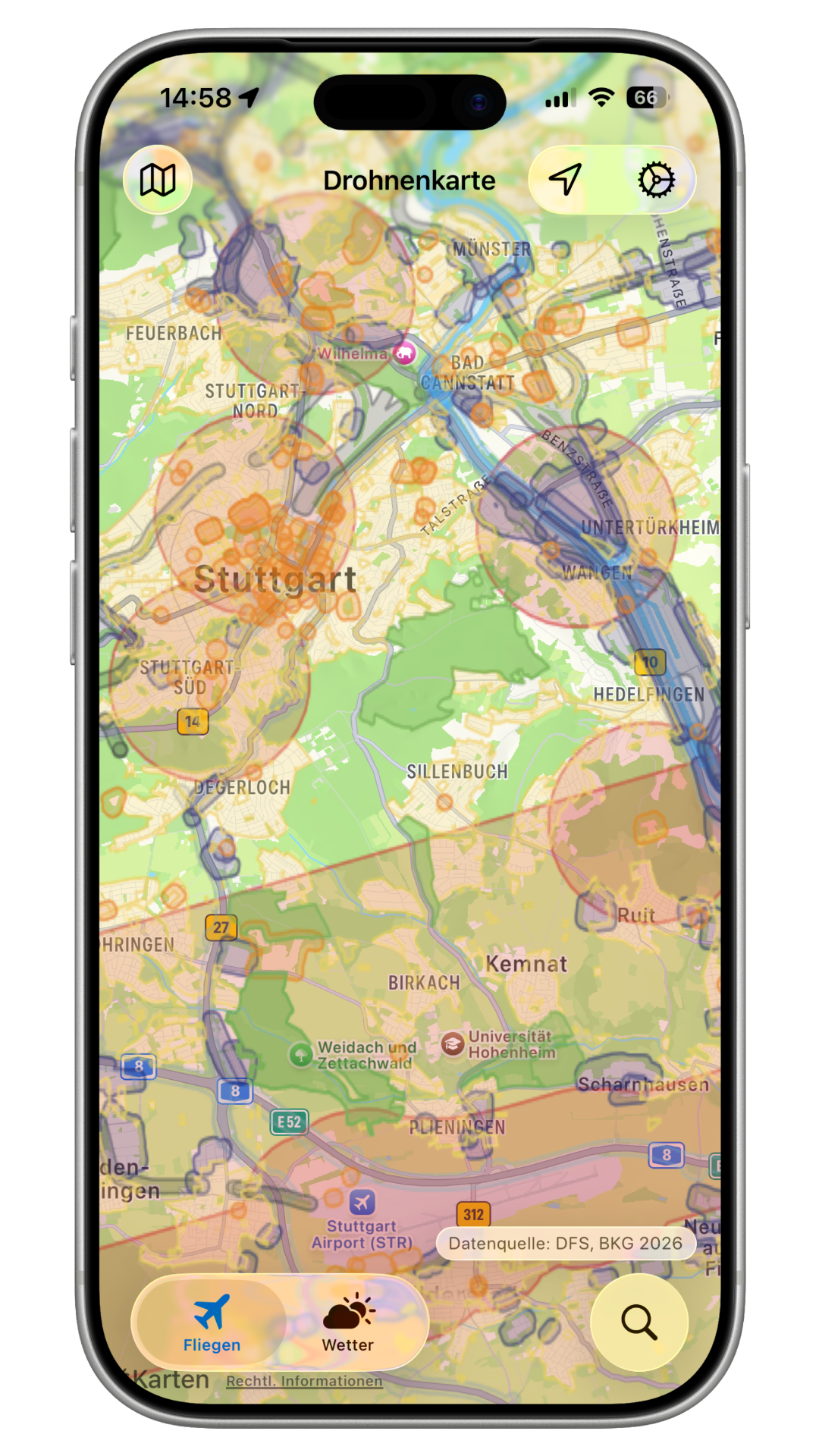
Designed for Precision Flying
Official zone data from 10 countries, offline maps for when the signal drops, and hourly forecasts tailored to multicopters.
Straight from the authorities
Every geozone comes from the country's own aviation authority, never a third-party aggregator. Germany runs live on official DFS and DIPUL data.
European countries
Germany is the core. Switch on any of nine more in Settings and cross the border without guessing.
Works without a signal
Pick an area, download it, and the base map keeps working with no connection. Offline zone packages are available for selected countries.
Wind at your altitude
Hourly wind speed and direction at 10, 50, 100 and 150 m AGL, plus gusts, from the DFS ICON-D2 model.
Tap any point
Every overlapping zone with its rule, altitude limits and the legal reference behind it.
Free, no ads
Every country and every offline download is included, with no ads and no tracking.
Open source
Safety decisions deserve scrutiny. Read exactly how a verdict is reached, or contribute.
xelemir/safeFLYTen countries. Ten official sources.
Germany is always on. Switch on any neighbour in Settings and the map follows you across the border, every zone traced back to the authority that published it.
Germany
CoreOfficial DFS and DIPUL data, live on the map. Always on, nothing to set up.
Austria
Austro Control
Belgium
skeyes / BCAA
Denmark
Trafikstyrelsen
Finland
Traficom / Flyk
France
DGAC / Géoportail
Luxembourg
DAC
Netherlands
LVNL / Rijksoverheid
Sweden
LFV / Transportstyrelsen
Switzerland
FOCA / swisstopo
Gaps are visible, not hidden. The map dims any area without data, and shades countries you haven't enabled yet.
Offline zone packages exist for selected countries. The base map downloads anywhere.
Privacy First
We do not track, log, or save your location data.
Local-Only Processing
Your GPS coordinates are processed entirely on your iPhone device to render overlays. We don't maintain analytics or tracking databases.
Direct DFS Aggregation
Map data is fetched directly from the German DIPUL server network. Standard access logs remain with the official map providers.
Support safeFLY
safeFLY is a personal project built with passion and is now fully open source. If the app has helped you, you can contribute to its code on GitHub or support its ongoing development directly!